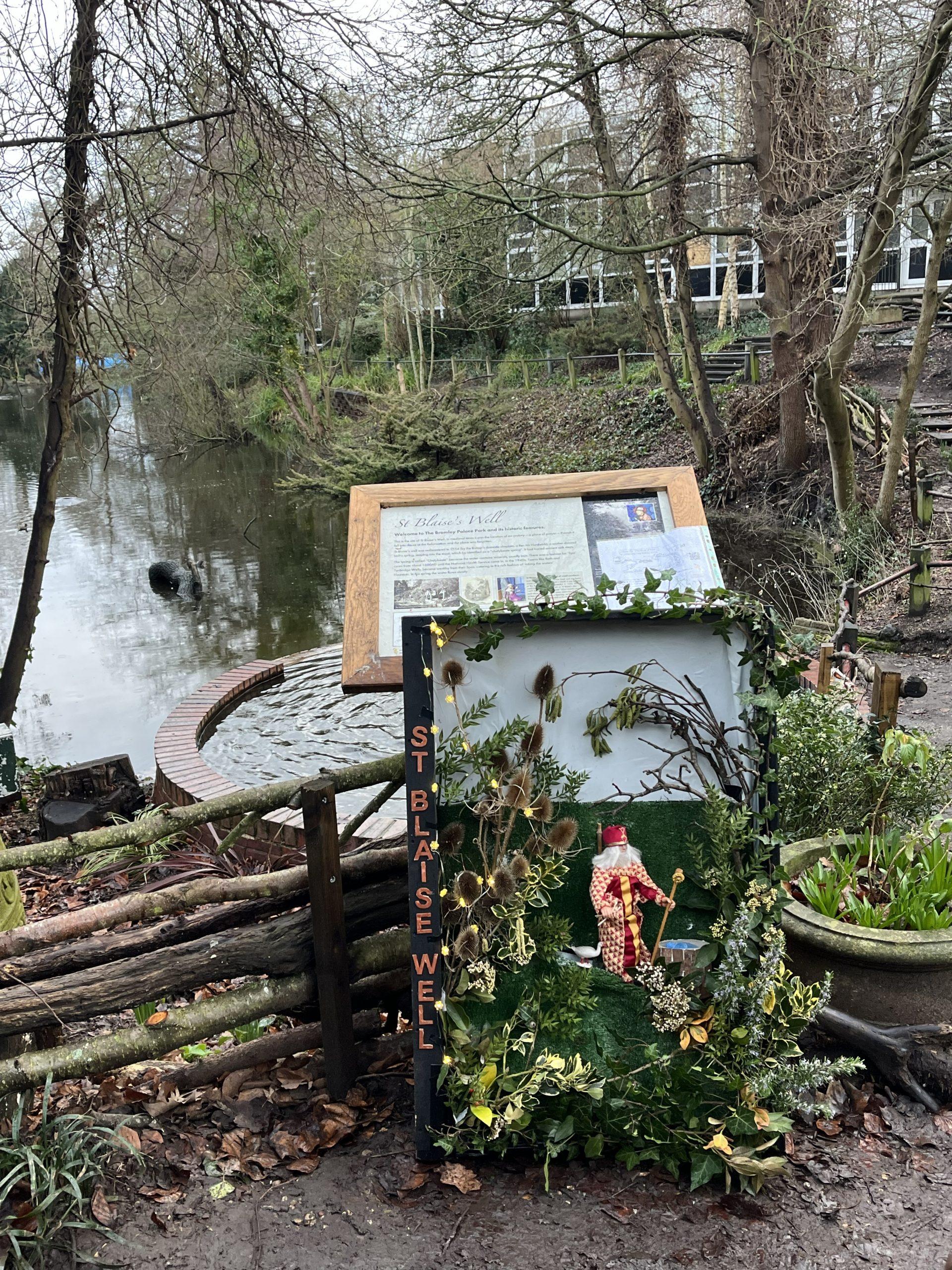
On Sunday the 1st February, the Friends of Bromley Town Parks and Gardens, held a traditional well dressing and blessing. Thanks to Father Saju from St Josephs RC church for conducting the blessing, the service and talk about the well. Despite the rain, 50 people turned out to mark the occasion!
St Blaise was a 4th-century Armenian bishop and martyr, celebrated as the patron saint of throat illnesses, wool combers, and wild animals. His most famous miracle was saving a child with a fish-bone caught in his throat.
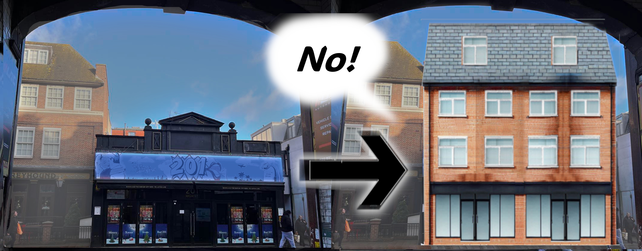
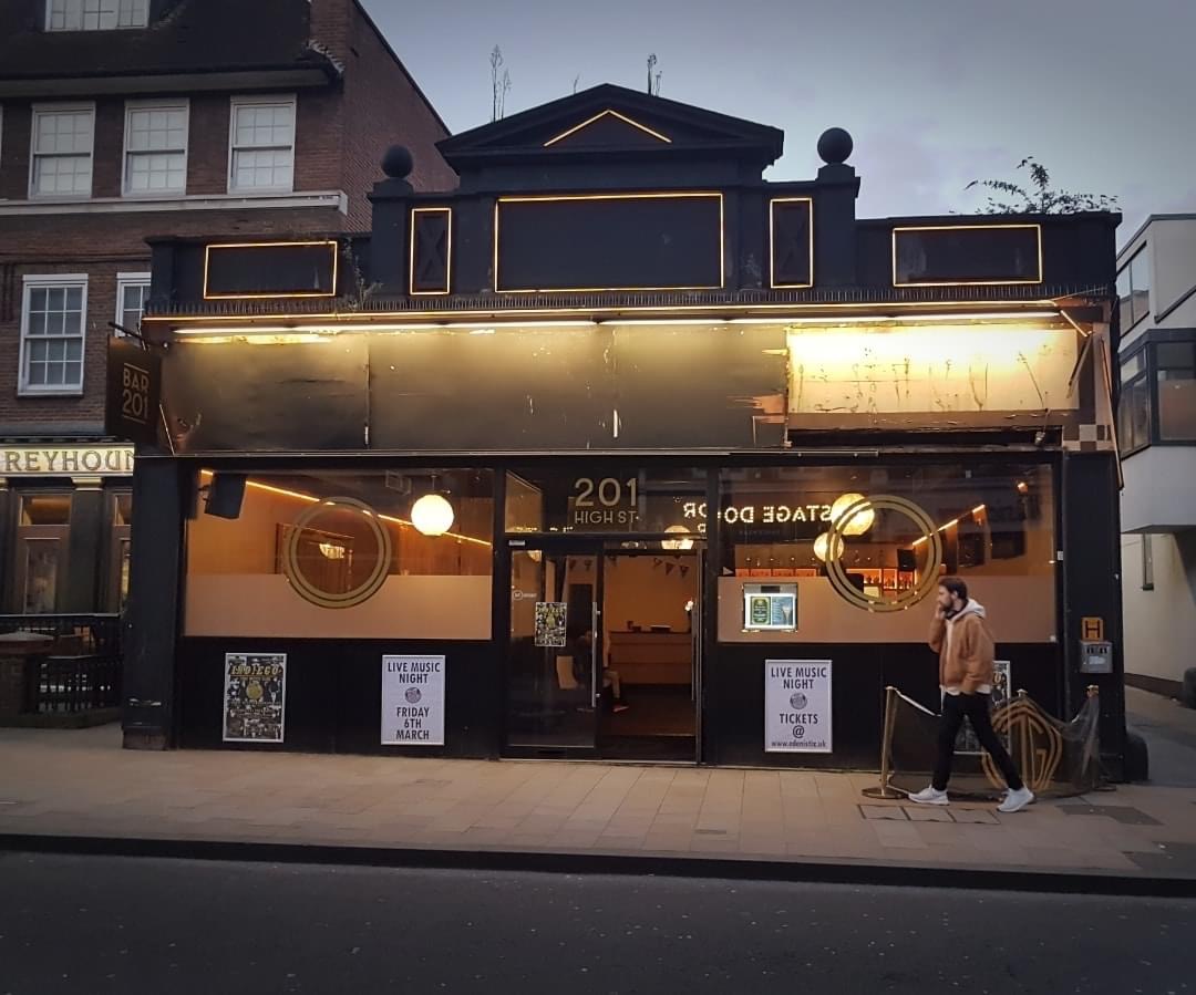
Update: Thank you to everyone whose objections meant that this lovely shop front, our piece of heritage has been saved! The application has been refused.
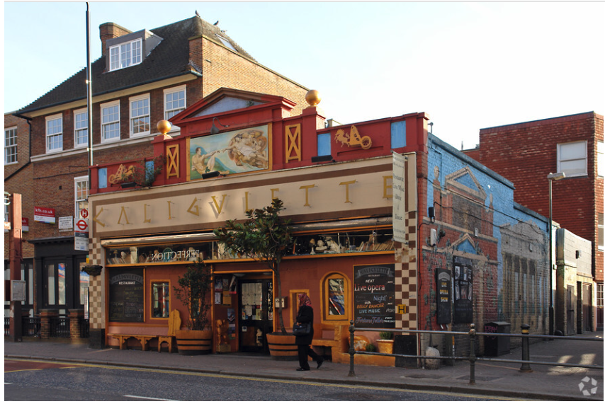
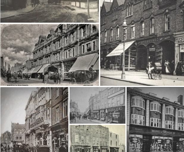
This beautiful Art Deco building is thought to have been built in 1885, when it is recorded as the shop for H.J. Luker, a ‘Silk Mercer’.
Happily, the 2024 planning application to turn this into a plain block of flats with a modern frontage was refused.
It has a distinctive Egyptian-inspired classical frontage, which is a much-valued part of the Conservation Area it is in.
In the Edwardian era the store was the Bromley outlet of The International Tea Stores Ltd., (https://en.wikipedia.org/wiki/International_Tea_Co._Stores) only a few years after Hudson Kearley and Gilbert Augustus founded the company to sell tea direct to consumers instead of through wholesalers.
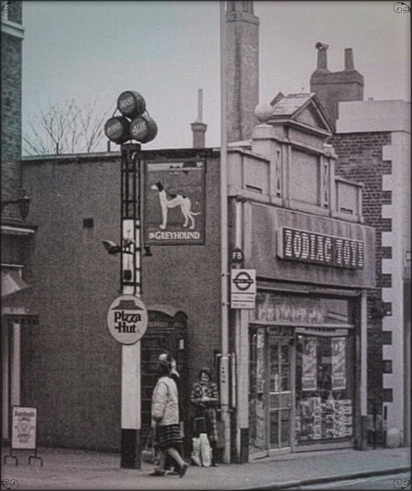
This building is well-remembered for being Zodiac Toys, a fondly regarded chain of 90 stores, mostly in South London. This shop also sold Prams. Before it was Zodiac Toys, it was Sidney Ross Toys & Pram shop and Youngsters Toys.
“I have fond memories of being taken to Zodiac.” (Matt Perrin in Bromley Gloss)
“Yep, Back in the mid 80’s I used to buy an outfit for my action man every week for 2 quid. Cosy days.”
“It used to be one of my favourite shops as a child, but never got to go in much. I got a a pair of roller boots from there. The blue and yellow ones with the zig zag down the sides. I was most upset when it closed.”
Zodiac toys was formed when Maynards confectionary decided to diversity in the 1970s due to their concerns about being dependent on the confectionary market. They launched their new brand with over 800 “keenly priced lines” in their self-service stores.
In the 2000s the building housed Calligulette, a fanciful Mediterranean restaurant that painted a lovely classical mural on their wall that faces onto the slip into Walters Yard.
The council has announced that they have accepted an offer from a developer for the freehold of the Churchill Theatre ‘site’. They state that this secures the future of the Theatre for the town
9/1 The Lime Avenue, former Gatehouse, and Palace Farm
Welcome to our heritage and biodiversity trail around the historic parks in Bromley Town Centre. This is the last stop! However, the first stop is just down the alleyway here.
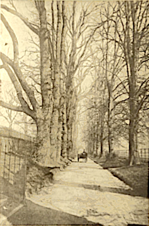
On the other side of the road you can see a row of trees that survived from the original entrance drive to the Old Bishops Palace (see stop 1/6 of the trail). The trees on this side were lost to the bypass. They look much younger in this picture! You can see the parkland fencing on the right hand side, whilst the left hand side was the back of properties along the High Street.
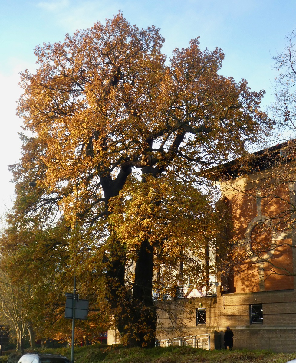
The Bromley Oak.
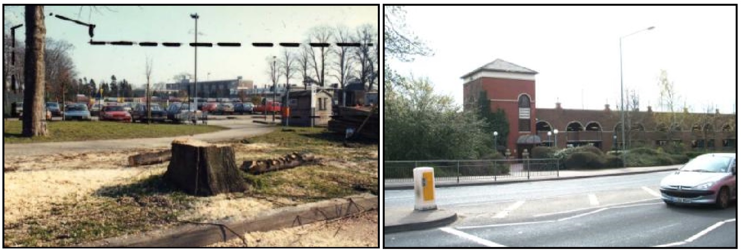
This tree has survived in the town centre, from being a sapling in a field hedge, to being at the back of the garden (of the house demolished for the Woolworths/Poundland building with a large semi-circular drivewau) in the corner with Love Lane, and now in the verge of the bypass.
The Bromley Oak in Autumnal colours
The alleyway running down the side of the former Civic Centre site is an old path that led to the Palace farm (about half a mile away). When Charles Cole-Child bought the Manor of Bromley from the Church Commissioners, he experimented with the cash crop of hops, so his home farm had three large ‘Oast houses’ which were used to dry the hops – apparently if they are not dried these flowers crumble and lose their flavour.
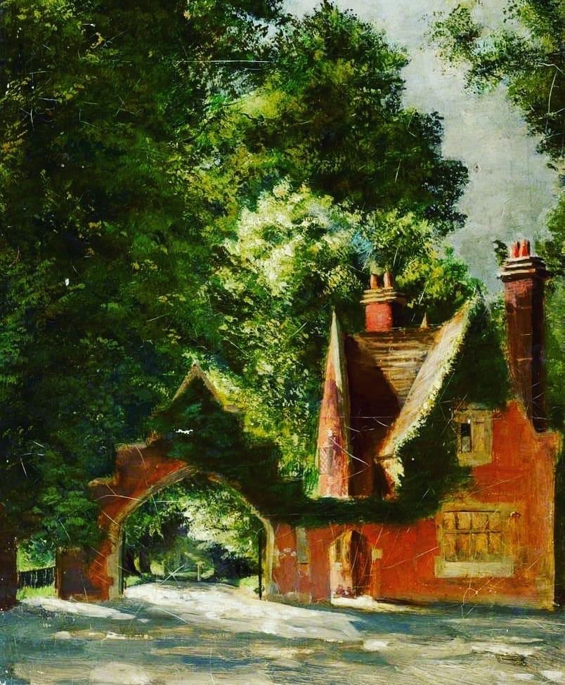
There was a lovely Arts and Crafts arch and gatehouse near here, designed by Richard Norman Shaw in the 1860s. This was part of the work done by the new Lord of the Manor, Charles Coles-Child, when he bought the title, rights and privileges – as well as the old palace – from the Church Commissioners.
Fun Fact
The bypass is built over the old Lovers Lane, an ancient and leafy track that led down to the Tigers Head Inn (now Crown of Bromley), complete with several ghosts!
All the stops in the Bromley Town Centre Parks Heritage & Biodiversity trail can be found on the page about it here.
To continue the Heritage Trail, go down the alleyway, and when it emerges onto Rochester Avenue, turn right into the former civic centre. Cross the car park diagonally to the large beech tree. Just down the old Carriage Drive is St Blaise’s Well.
College Green, the K2 Telephone Kiosk (Box) and the National School.
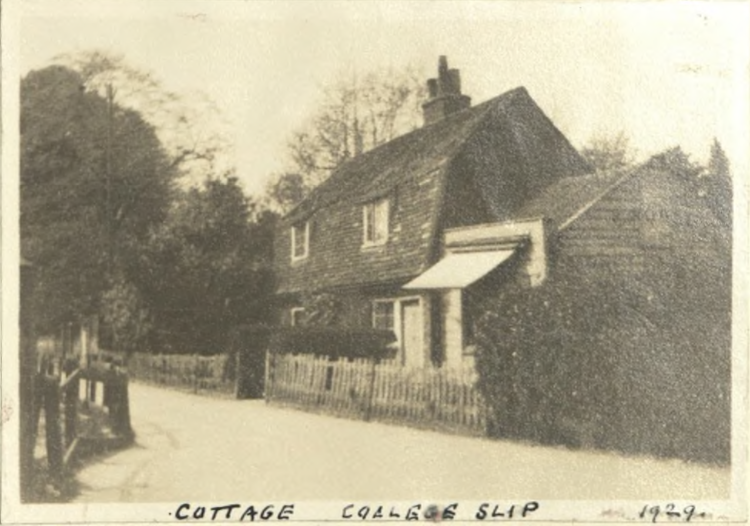
Welcome to College Green. This location is a stop on the heritage and biodiversity trail around the historic parks in Bromley Town Centre. There is a page on College Slip and College green on the Bromley Civic Society site here, it talks about the locally famous seedsman who lived in the little cottage you can see, J.R.Pocock.
College Slip
.
The park was formerly a plant nursery, to supply food to the Clergy widows living in the (collegiate) Colleges.
In the Victorian era it supplied both vegetables and bedding plants to the town, and when it was closed in the 1980s, it had been the longest running plant nursery in London. The house on the alleyway is the Seedsman’s Cottage, where the gardener lived.
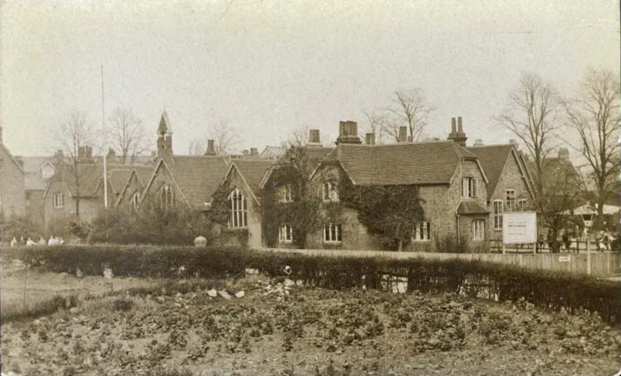
On the opposite side of the road, where the Methodist Church now is, was the Parish School, built in 1854. It was designed by the eminent architect James Piers St Aubyn, who also designed the romantic additions to Saint Michael’s Mount in Cornwall. It suffered sudden weekend demolition in 1980s as part of the Glades development, to thwart attempts to save the building. There’s a page on the school here.
Fun Fact
The local famous author, HG Wells, described the town’s education in his autobiography:
“Bromley was served by a National School… It was the mere foundation of an education…Even that … had been achieved against considerable resistance. There was a strong objection in those days to the use of public funds for the education of “other people’s children,” … [of the teachers] crudely trained mechanical grant earners of the contemporary National School … that my mother’s instinct was a sound one in sending us all to this antiquated middle-class establishment.”
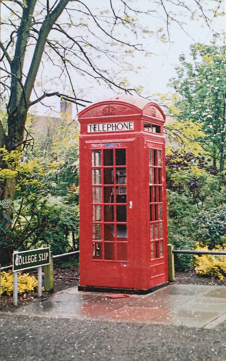
The Phonebox is and iron-framed K2 model, designed by designed by Giles Gilbert Scott. Though this is ‘K2’, it is the oldest model found, as K1 was a concrete prototype that did not leave the headquarters.
The original Telephone box, called Kiosk 2 (because K1 was a grey concrete prototype)
All the stops in the Bromley Town Centre Parks Heritage & Biodiversity trail can be found on the page about it here.
To continue the Heritage Trail, cross the road and go down leafy North Street. At the end, go past the Railway Tavern and turn down East Street. In another 100 meters turn left up South Street, then right down Court Street. Cross the street diagonally and go down next to the car park, this emerges into Queens Gardens. Turn left here, and continue to the edge of the park by the crossing.
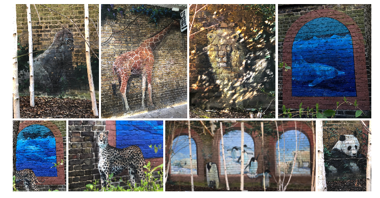
Many long term residents are suprised to be told that Bromley has a zoo, and then when it is revealed to be a mural, determine to find it themselves.
Bromley Zoo is a much loved and playful installation in Naval Walk, an alleyway off the north 1901 terrace of Bromley High Street.
A panda and lion lurk among the shrubbery and a variety of animals are presented in cunning trompe l’oeil (trick the eye) scenes. The artwork, by Bruce Dickinson in 2001, was part of the Bromley North Village Project which aimed to help reinvigorate a tired area of Bromley high street, to lead the shoppers from the car park to the High Street shops, see more here.
All the stops in the Bromley Town Centre Parks Heritage & Biodiversity trail can be found on the page about it here.
To continue the Heritage Trail, turn left down the alleyway to Bromley High Street. Turn left and in 50 meters you can turn right down College Slip. At the end of this is the K2 Telephone box.
Welcome to Martins Hill. This location is the second stop in this park, on the heritage and biodiversity trail around the historic parks in Bromley Town Centre.
Deadmans steps is another old name where the origin has been forgotten, but some local history experts think that the name is due to the steps being on a Medieval “coffin way”. The bottom step is where the coffin would have been unloaded, to be carried on people’s shoulders, because the hill was too steep for the horses to continue.
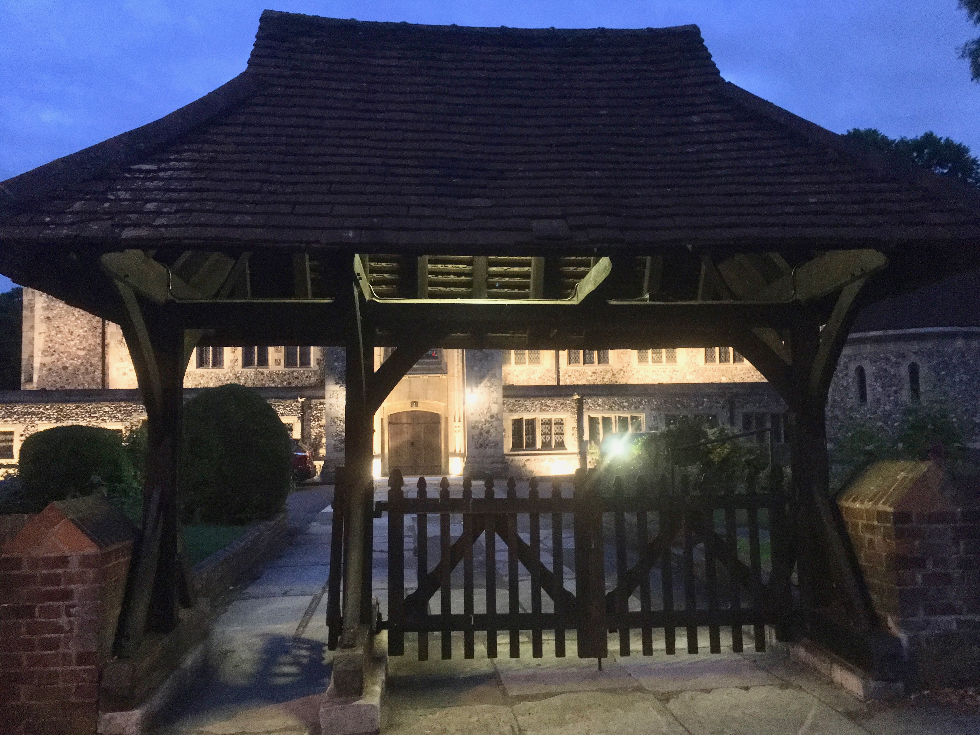
It was a requirement (and revenue) in the medieval era to only bury people at the Parish church, which in some cases could be quite a way from where people on remote farms lived. The funeral would be held at the Lych Gate of the church before the body was buried in ‘the ‘hallowed ground’. Lych is a corruption of ‘Liche‘ which was early English for a dead body.
Fun Fact
It was believed that ghosts would travel the Coffin Ways at night – Shakespeare in Midsummers Night Dream says “Now it is the time of night That the graves all gaping wide, Every one lets forth his sprite, In the churchway paths to glide.”
Deadman’s steps is also known locally to be haunted: a badly injured man in breeches and waistcoat can be seen lying in a pool of blood at the top of the steps.
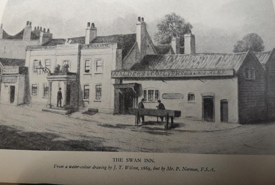
The Swan Inn in 1869, belonging to Mr P Norman FSA. Nalders and Collyer were local brewers who built The Railway Tavern and rebuilt the Star and Garter.
The road at the bottom of the steps used to be called ‘Swan Hill’ – as the inn at the top is called The Swan and Mitre. Locals say that the swan represents the bishop’s mistress, but unfortunately not which Bishop it was (or even which actress!). The Bishops of Rochester have been Lords of the Manor in Bromley for over a thousand years. However, the Swan and Mitre public house is connected with an actress, Marie Lloyd, and her dressing-room mirrors are still there.
All the stops in the Bromley Town Centre Parks Heritage & Biodiversity trail can be found on the page about it here.
To continue the Heritage Trail, go down the steps and up the hill to the junction. At the car park entrance, turn right down the uphill side of the car park, and the Bromley Zoo mural is on the wall to the left.
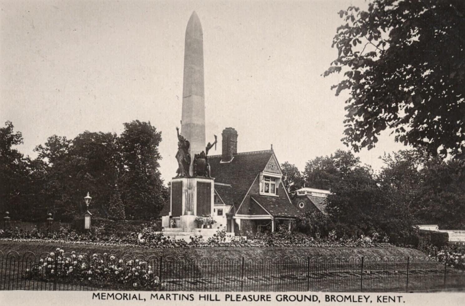
Welcome to Martins Hill, this is Bromley town’s war memorial This location is the first stop in this park, on the heritage and biodiversity trail around the historic parks in Bromley Town Centre.
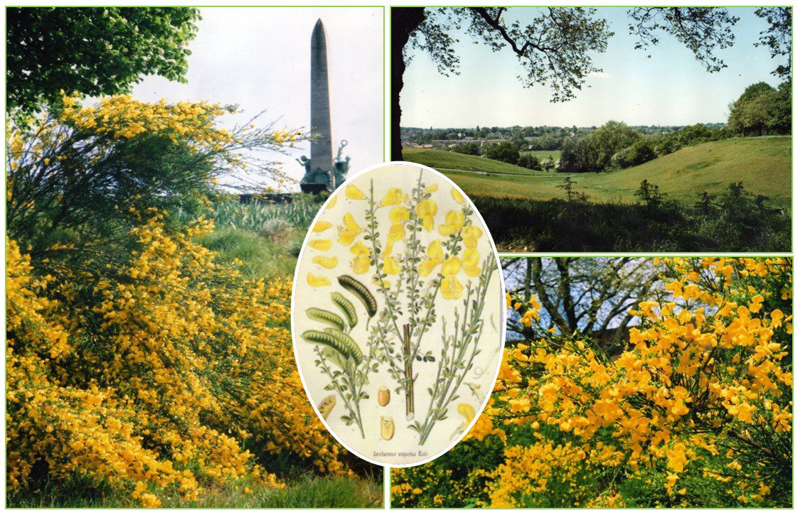
Broom flowers on Martins Hill
The origin of the name Martins Hill is lost in time, but the likely explanation is that the martins (a bird like a swift or swallow) used to circle in the thermals created by the slope. There used to be a lot of sand martins in Bromley, they nested in holes in the sandy banks and walls of various gravel pits.
Martins Hill entrance with the war memorial, formal beds, and lodge.
War Memorial by Sydney Marsh
Originally there were some formal beds and a drinking fountain at the top. After the war the memorial was moved to the bototm of the hill (Queens Mead Recreation Ground) and the sculptor Sydney March (who also designed the National War Memorial of Canada) created the rather splendid memorial there today. It is made from Portland limestone, and the figures are Liberty, Victory and Peace.
Fun Fact
Martins hill was the first public park in Bromley, but only after a campaign to save what was left! An anonymous supporter wrote this ditty about it:
“On this, the people’s piece of land, May builder never ply his skill. May never innovating hand deprive the town of Martin’s Hill.”
The path coming up the hill to this spot, the bends at the bottom were a drovers road up to the market square, where there were butchers. Without refrigeration, the butchers shops slaughtered the animals in the yard behind the shop.
Broom flowers
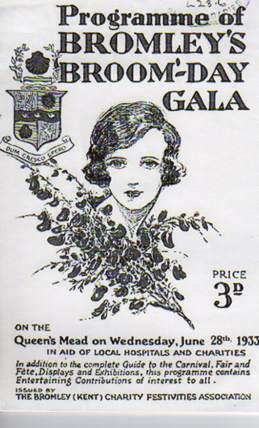
Programme for the town’s annual Broom Day celebration
Martins Hill is the last place that the Broom – the flower Bromley is named after – can still be found. Initially abundant, the park was the only place left after all the area came into cultivation. Bromley has started holding the Broomtime festival again on the 2nd weekend in May (normally; it may vary).
The Civic Society’s page on Martins Hill, with some more old photos, is here.
The Friends page on Martins Hill with lots of information about the acid grassland and Field of Hope daffodils is here.
All the stops in the Bromley Town Centre Parks Heritage & Biodiversity trail can be found on the page about it here.
To continue the Heritage Trail: (1) longer route – go down the path lined by lime trees along the top of the park until Deadmans steps, down to the road, are reached. (2) shorter route – retrace steps to the gates, turn left down the road to the High Street. Turn left up the High Street, then right into Walters Yard. Go left and right to the front of the supermarket, then left to the far corner of the car park. The gap here takes you to the K2 phone box.
Welcome to Bromley Palace Park and it’s historic features! This location is the fourth stop in this park, on the heritage and biodiversity trail around the historic parks in Bromley Town Centre.
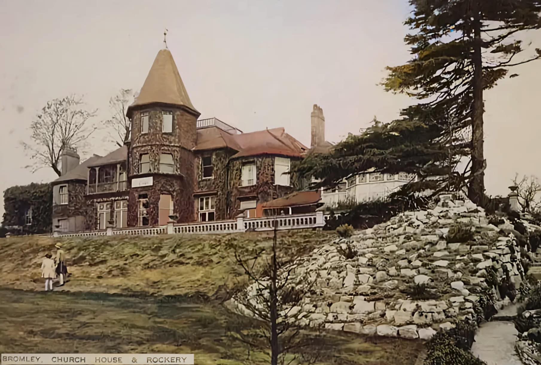
On this site there was a fine gothic house, with a tower, large conservatory, and large terraced Garden. Looking out towards the Church, you can see the former Carriage Drive – with the circular end for horse-drawn carriages to drop their passengers at the door. You can also see the walls of the former walled kitchen garden (currently a depot, though there’s proposals to build flats there).
In the first world war, from 1914 until 1919, the house was used as a Red Cross VAD (Voluntary Aid Detachment) hospital for wounded soldiers. The VAD scheme predated the war, but with the high level of casualties on the Western Front, there were 2.5K of these hospitals in the UK. Recently some photographs have been found from this time, and they are available on the borough Local History society site, here. One of the patients wrote home to Shetland from Church House.
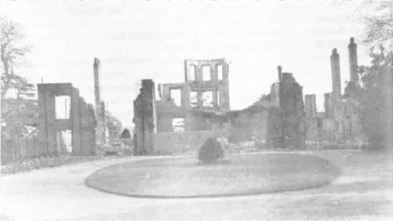
Church House bombed out in 1941
On the night of the 16th April, 1941, in WW2, a German bombing raid dropped an incendiary bomb on the house and it burnt to the ground. All the churches in central Bromley were also bombed that night, and a large store in Market Square. The rubble from the parish church blocked access to the house, so firecrews could not reach it and fight the fire.
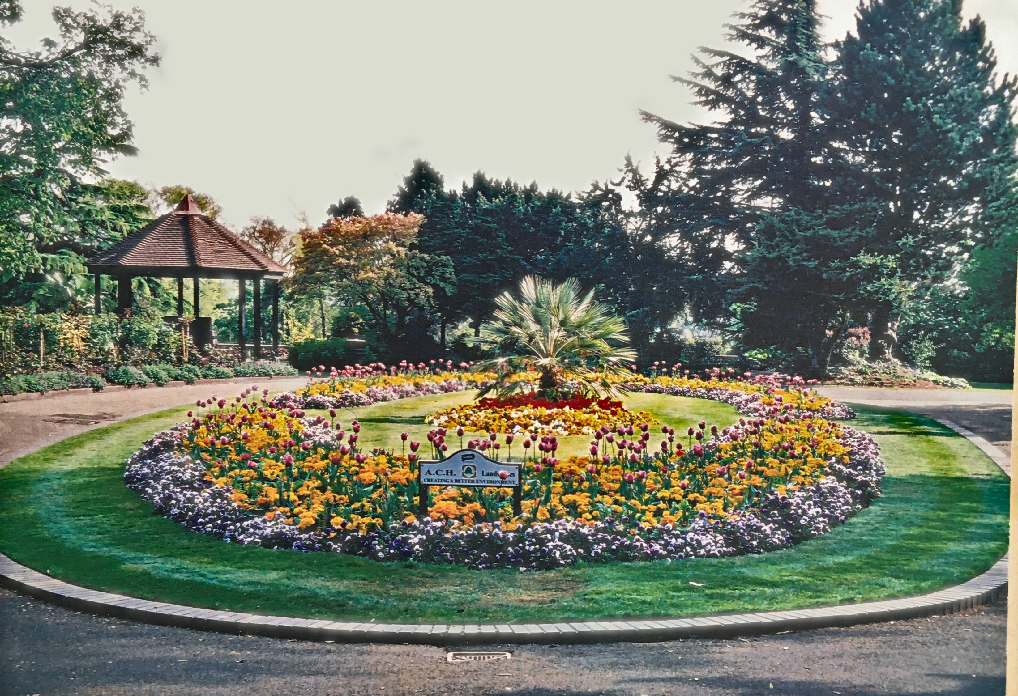
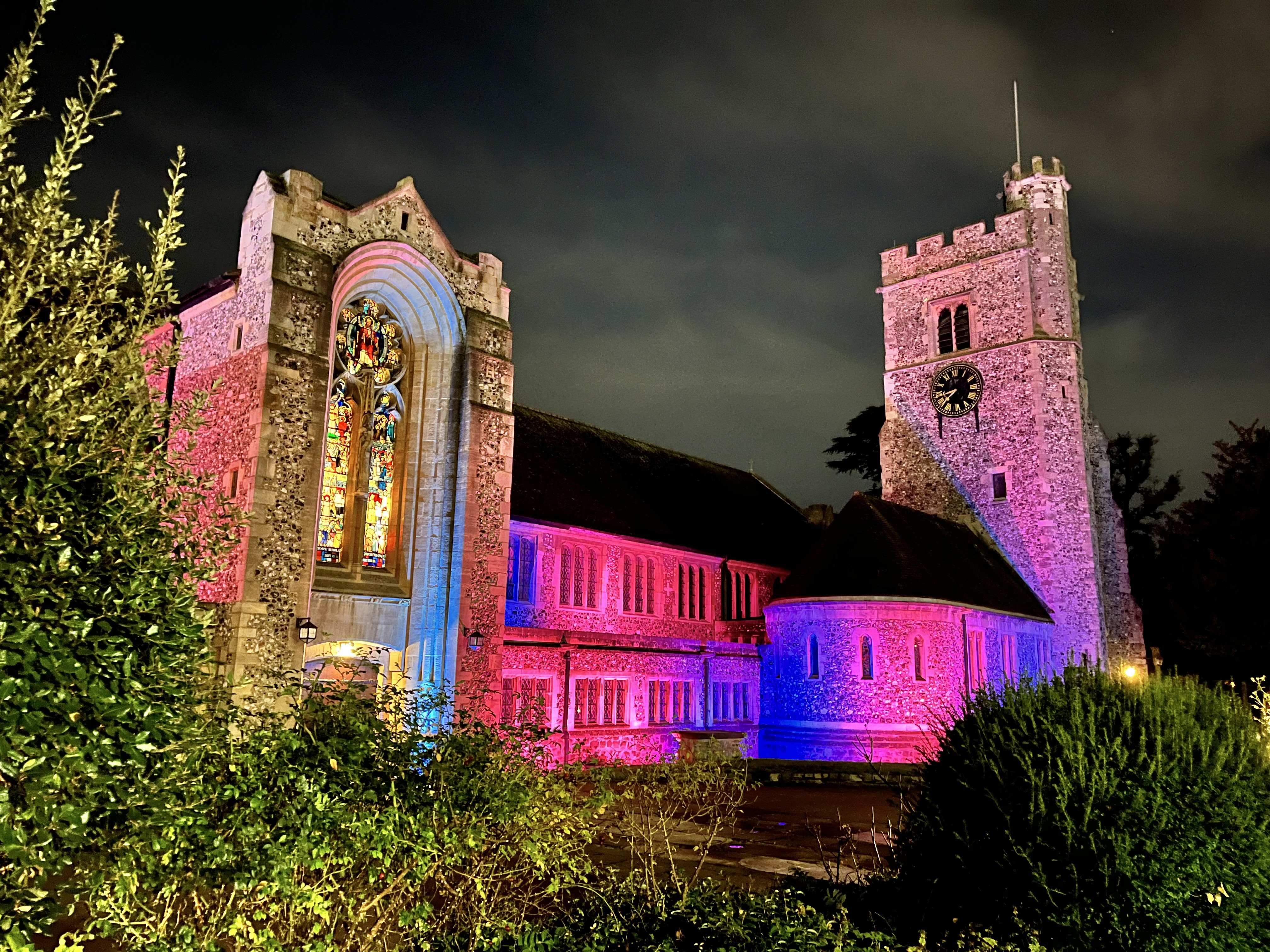
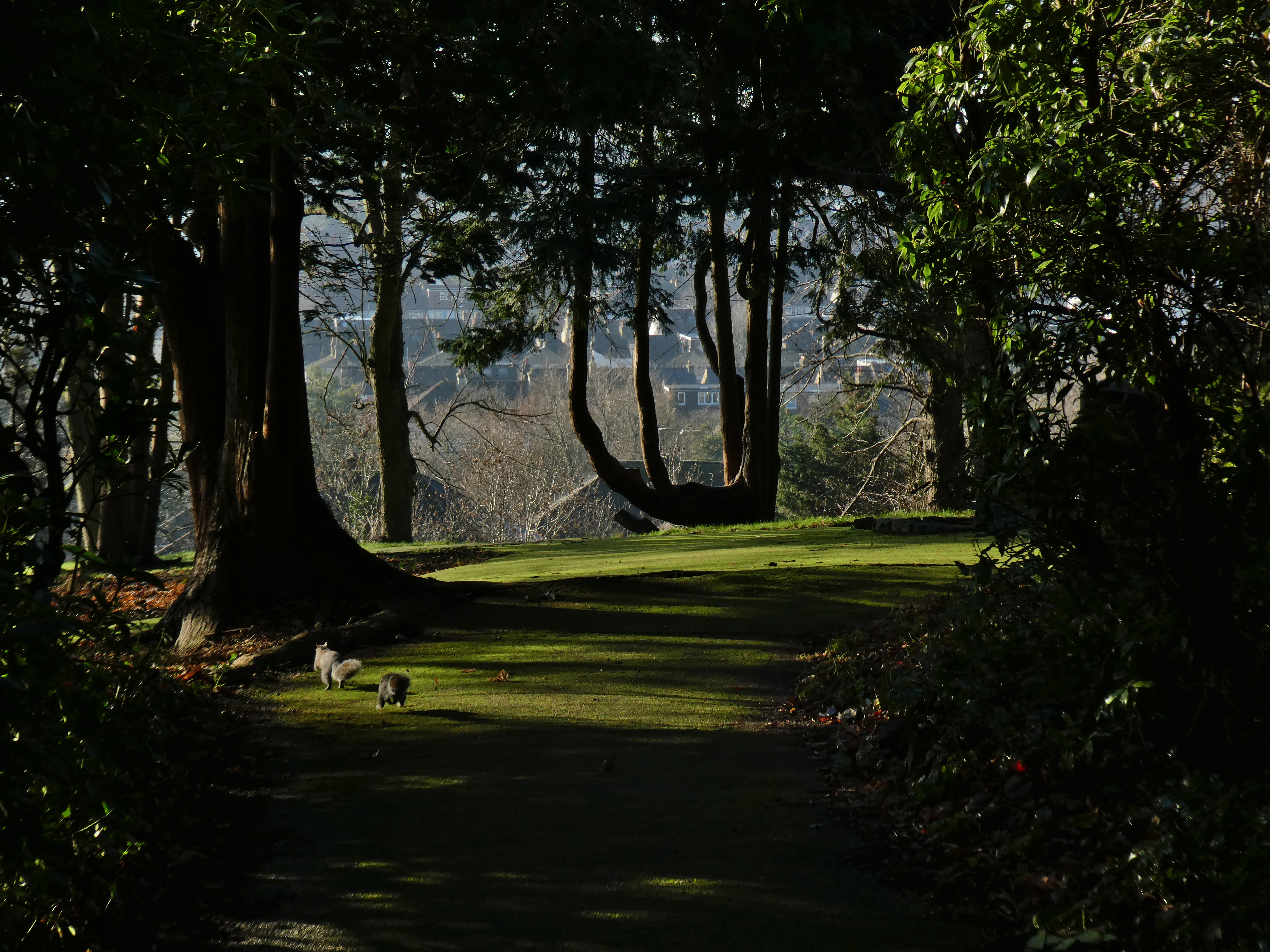
The Carriage Drive flowerbed, by Tony Banfield in 2010.The Parish Church of St Peter and St Paul in October 2023. The Church that ‘Church House’ is named for.Cypress tree silhouetted against the Ravensbourne Valley, January 2022.
In recent years the flowerbed in front has won awards.
All the stops in the Bromley Town Centre Parks Heritage & Biodiversity trail can be found on the page about it here.
To continue the Heritage Trail, follow the little path (on the right hand side of the Carriage Drive) and on your right there is a rocky cliff – this is the fernery.


 Browse our old photos, in